Maryland Community Compass
Maryland's neighborhood development data platform.
- Category
- Data & Analytics
- Primary Subcategory
- Geospatial & Spatial Analytics Data
 View in the Claude registry
Integration details
Description
Maryland Community Compass is the State of Maryland's free neighborhood development platform that centralizes data insights, funding resources, and support to foster thriving businesses and communities statewide, built by the Maryland State Innovation Team in partnership with Anthropic. Since December 2025 it has served over 15,000 active users and helped guide nearly $14 million in state funding to high-need areas. Its MCP server exposes 20 read-only tools that let Claude answer questions about any Maryland address, parcel, or geography. No authentication is required, though requests must come from a US-based network. Find Funding: 2,600+ federal, state, and philanthropic programs aggregated from 100+ sources, spanning grants, loans, tax credits, and technical assistance. One of the most comprehensive databases of public and private funding in Maryland. Full-text search, filters, and profile-based recommendations that help assemble a capital stack for any project. Site Feasibility: parcel-level evaluation across hundreds of federal, state, and local datasets. Property records, Maryland place-based program overlays (Opportunity Zone, Enterprise Zone, Sustainable Community, and more), environmental cleanup sites, historic register listings, conservation easements, green infrastructure, and Baltimore City Vacant Building Notices. Includes full zoning ordinance text for all 23 Maryland counties and 96 municipalities with independent planning authority. Community Plans: nearly 200 published comprehensive, small-area, and neighborhood plans. Search inside any plan (for example, "what does the Fell's Point plan say about parking?") with citation-ready PDF URLs. Neighborhood Insights: 58 census-tract-level metrics (poverty, tenure, cost burden, rental vacancy, permits, and more) with state and county medians for comparison.
- Integration type
- Connector
- Verification status
 Verified connector
- Platform
- Claude
- Primary Subcategory
- Geospatial & Spatial Analytics Data
- Secondary Subcategories
- None listed
- Access
- No account required
- First tracked
- 2026-08-31
- Tool count
- 20
- Geography
- US
The Primary Subcategory used for this profile’s headline score.
Other Subcategories where the Integration is listed.
Claude Discoverability Score
Your Claude Discoverability Score is being prepared
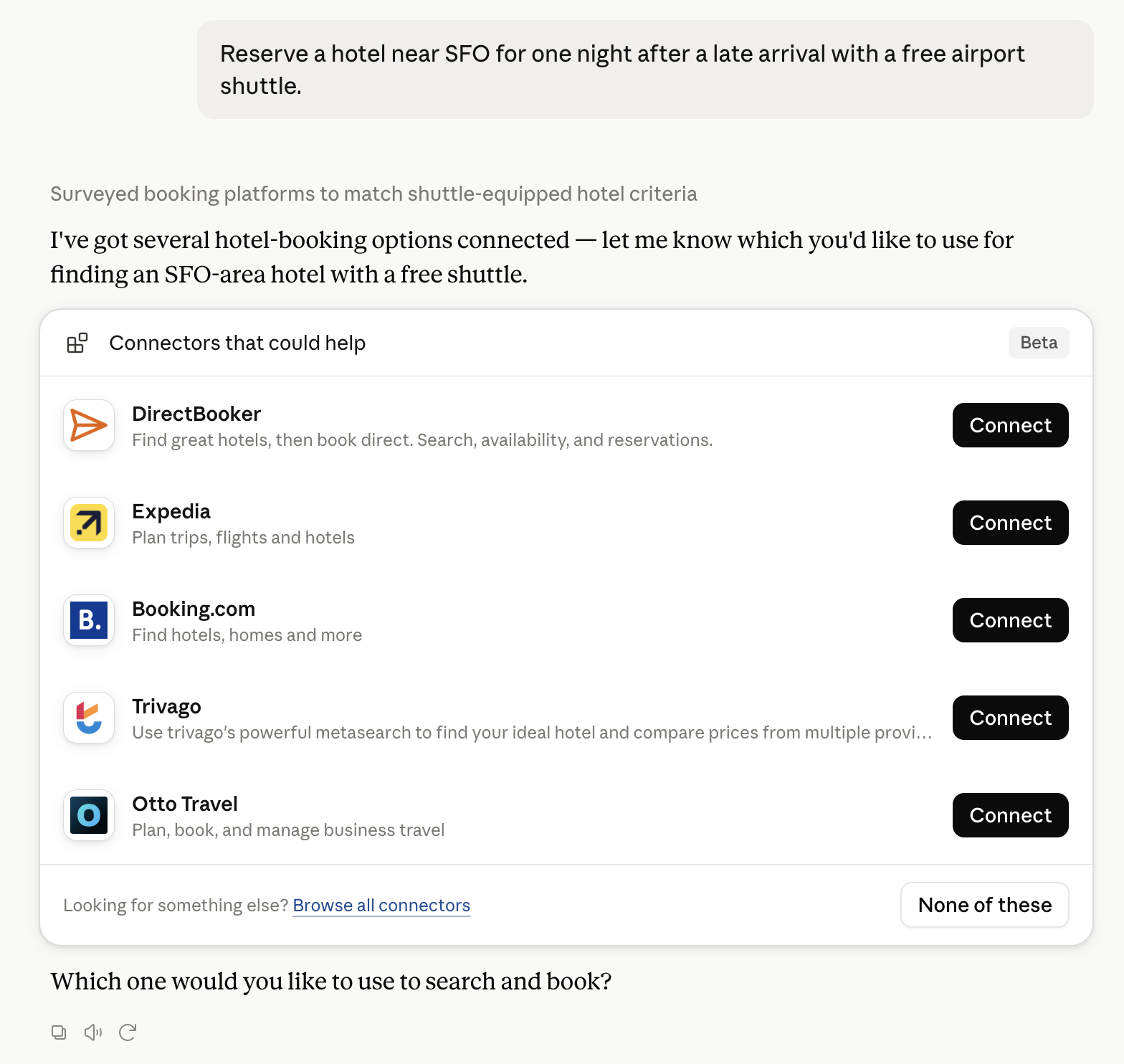
Claude can surface a verified Connector when it matches a user’s Prompt.We are preparing Maryland Community Compass’s Discoverability Score and will publish it when the benchmark is ready.
No spam. Unsubscribe any time.
No spam. Unsubscribe any time.
What discovery looks like
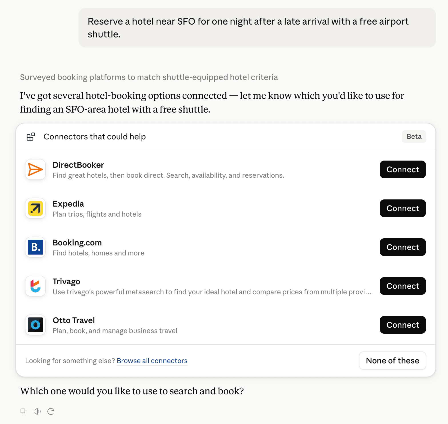
Claude can surface verified Connectors when they match a user’s Prompt.
About Claude's Discoverability Score
Your Connector now competes to appear for users’ prompts
Competing in Claude Geospatial & Spatial Analytics Data
View Category20 tools agents can invoke
How do I improve a Verified connector's discoverability?
The levers are the listing surface agents actually read: names, descriptions, keywords, tool metadata, and registry health. Which lever matters depends on where discovery breaks, which is what continuous measurement shows.
What are Maryland Community Compass alternatives on Claude?
As of 2026-09-13, Maryland Community Compass competes with Felt Maps, TomTom Maps, GIS Cloud, Alloy Robotics, BigGeo AI, SkyWatch, Swath API, Wherobots Spatial AI Assistant in Claude Geospatial & Spatial Analytics Data, ranked by public Discoverability Score.
Where is this profile measured?
This profile uses the geography attached to the latest public registry snapshot: US. Locale tags are intentionally omitted.